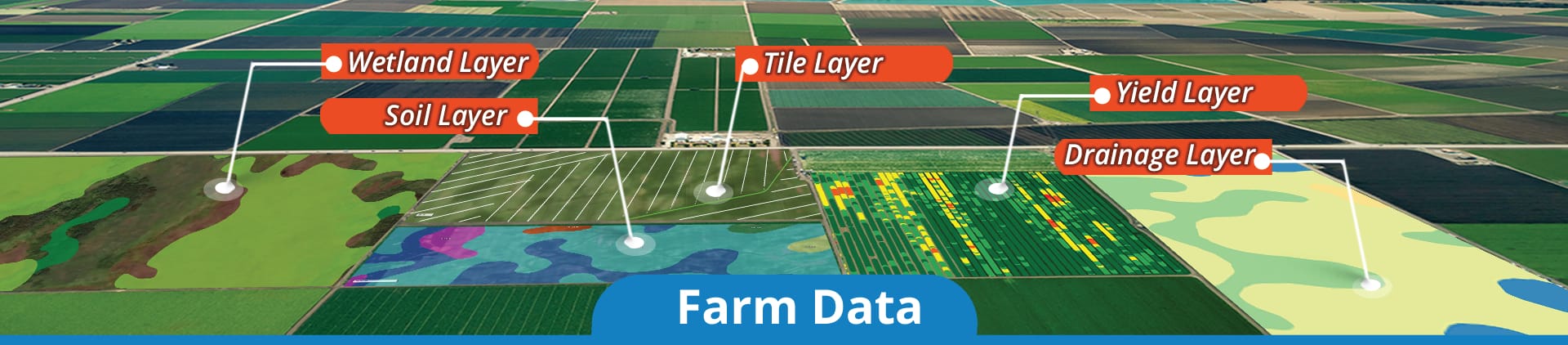
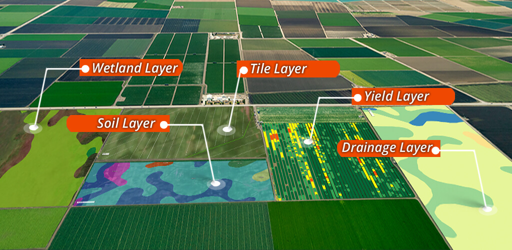
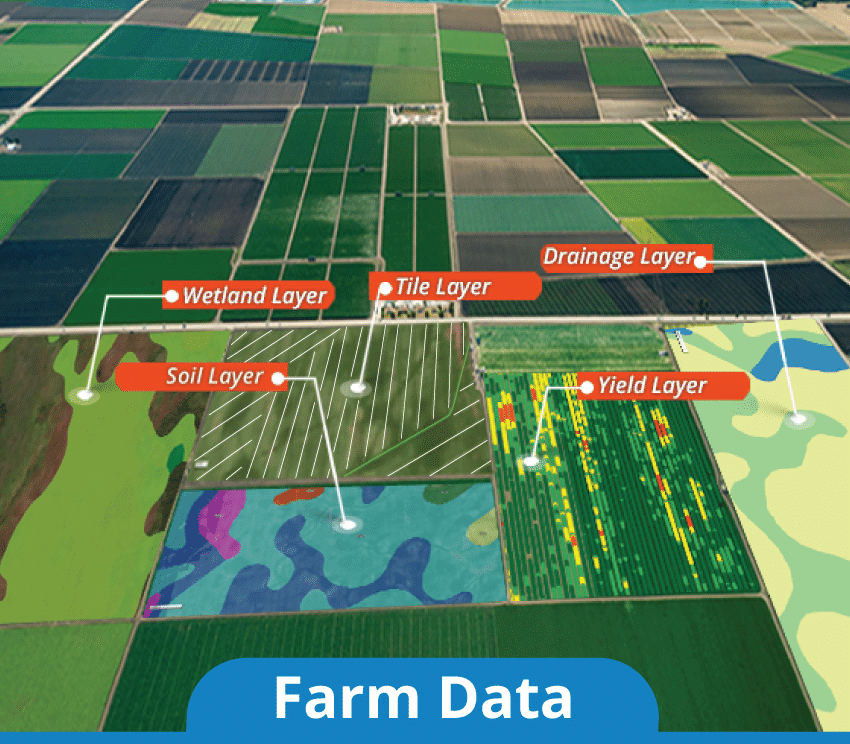
You’re busy managing your farm. You don’t have time to use multiple sources of information to find the data you need to make informed decisions. Our Farm Data Module gives you “1-Click” solution to ALL your farm map and data needs.
Gain access to soil data for the boundary, provided by the NRCS SSURGO database.
Drainage
View drainage data from the app. The drainage classes are split into seven different types based on the rate that water moves through the soil.
FSA
See Farm Service Agency digital border data overlaying an aerial image of the selected boundary.
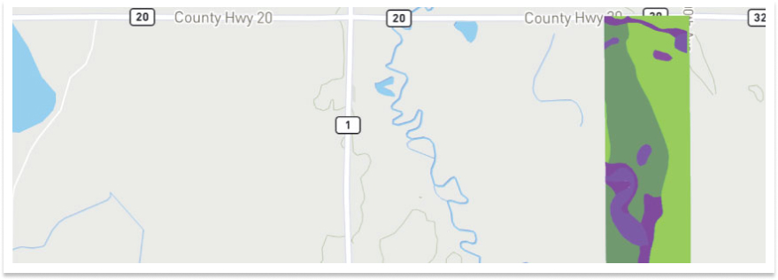
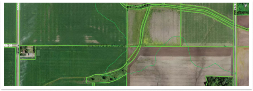
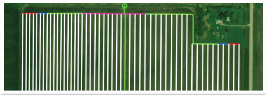
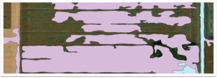
Tile
View a map and attributes of the subsurface drainage installed in a field.
Parcel
Identify a property’s boundaries on a map.
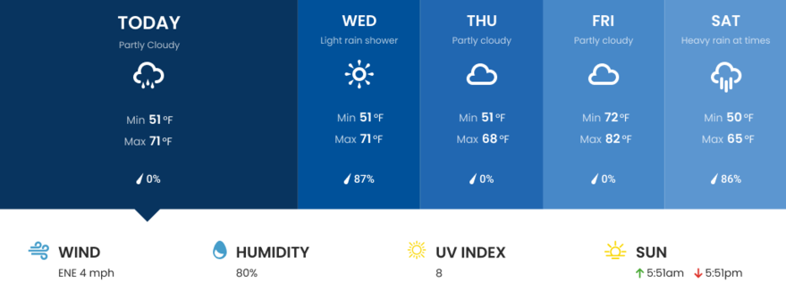
Weather
Check the local weather forecast.
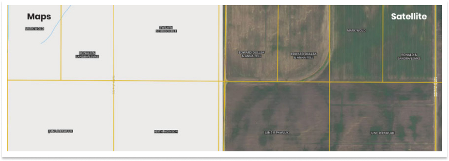
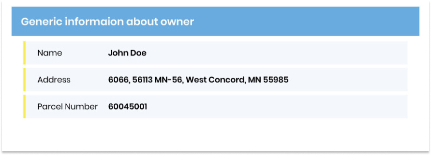
Ownership
Legal ownership information of a farmland.
Crop History
Examine a four-year crop history breakdown for the selected boundary.
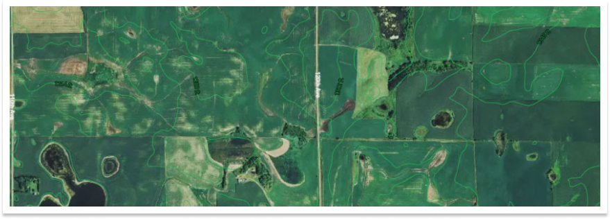
Topography
View elevation statistics with two styles of maps. A topography map displays a two-dimensional representation of the 3D surface. The contour map shows the contours for the boundary over an aerial image.
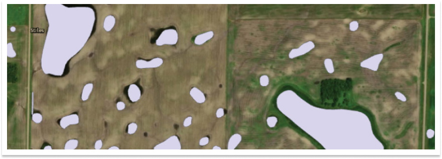
Wetland
See the type of wetlands within the boundary.
FEMA Report
Pull up the flood zones and FIRM panels that are present in the selected boundary.
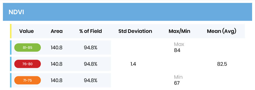
NDVI
See the statistics and map for the Normalized Difference Vegetation Index (NDVI). This is a simple graphical indicator of the vegetation biomass. It uses near-infrared and visible red reflectance to create an index number.
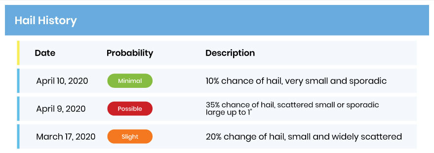
Hail History
Read a report of all hail activity in an area for the year selected.